
I first came across the High Peak Way on the Long-Distance Walkers Association website, but when it came to checking the route it for this attempt, the web page was nowhere to be seen. A quick search brought me to ramblingman.org.uk and confirmed that I wasn’t making it up and the route did in fact exist. Piecing together the information I was back on ride with GPS to plot the route. 30 miles with around 2000m of vertical, it was set to be one of the hillier runs I had attempted, but all good training for what I have planned.
Journey in
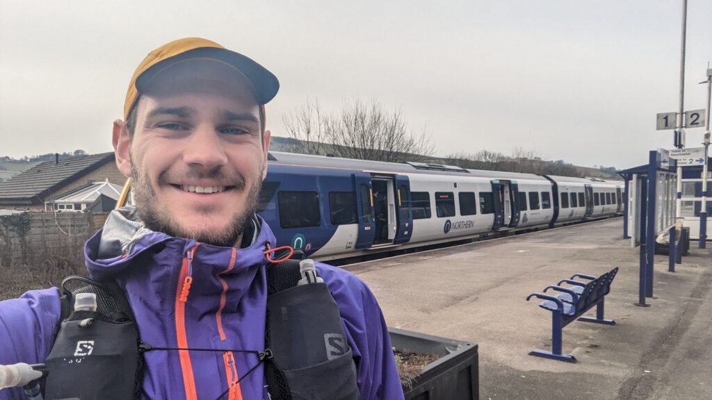
I had intended to get the 08:15 train to Chinley from Sheffield for a 9am start, on Saturday. This would give me plenty of time to enjoy the route and get to Grindleford station café for coffee and cake before the 4pm closing time. However, imminent snow meant I pushed my plans forward to the Wednesday to miss that bad weather. Poor decisions meant I was catching the tram as my desired train departed, meaning the 09:15 was my next shot. A full hour lost. Not to worry, I was aiming for about 5 or so hours so my daydreams of cake should still become a reality.
It did mean that I was on one of the school run trams, packed full of kids. One unashamedly was on facetime, volume on full sharing their conversation with the whole carriage. I had forgotten my headphones for the trip and was about to grab a Metro paper when an old man decided to take residence right in front of the display.
Instead of switching from the yellow to blue line to get off at the station, I walked from Fitzalan Square against the flow of commuters from the station. Once inside I double checked my train was indeed still running and set up camp in the café on platform 2 as I waited the 30 minutes for the train to arrive. A cancelled service to London caused much confusion once the Manchester Piccadilly service arrived, leading the station attendants to answer the same questions over and over again.
Chinley to Barber Booth
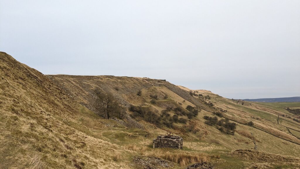
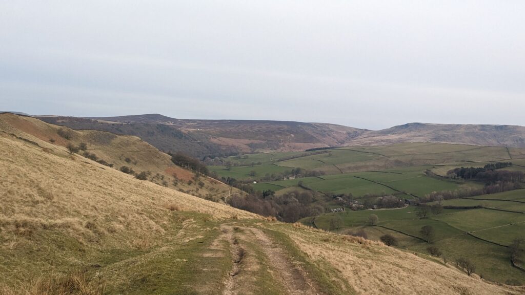
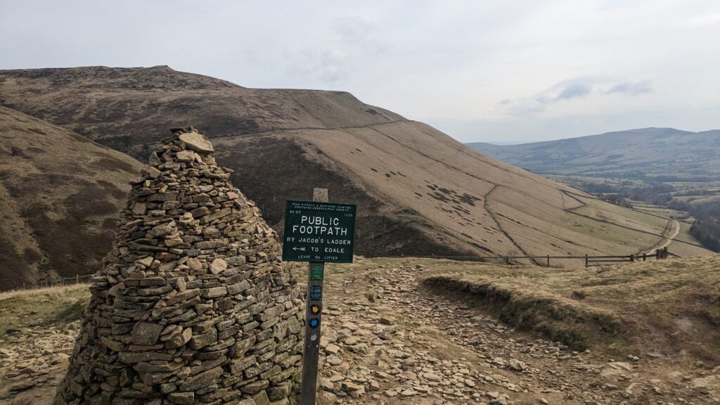
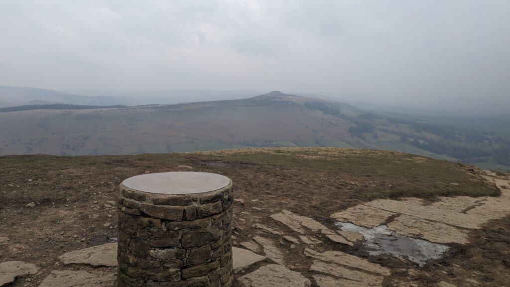
Leaving the station, I passed over the platform’s bridge and passed a cyclist who had just departed the train before me. I padded my way through Chinley, taking in the fresh air and limbering up for the day ahead. Two right turns and I was crossing back over the railway and rising through Chinley Park Nature Reserve. A hidden gem, the trees here had an almost ethereal form in the day’s light. It was peaceful. A small dog sniffed about in the grass. And then I am leaving, still climbing but now along a farm track to Cracken Edge Quarries. The path slowly steepens here until I was practically sliding backwards on the slick mud steps. The descent down to the A624 was pleasant, and I easily crossed thanks to a cyclist. It was now another long descent to the river Sett, before rising to just below Kinderlow Cavern, passing a trail of hikers on the way up, each one being the next target to pass before the gate. A controlled fall down Jacob’s Ladder and I was well on my way to Barber Booth.
Barber Booth to Lose Hill
A cyclist let me cross the road as he contemplated tackling the Mam Tor climb. I too had a similar contemplation, but the thought of cake and a coffee with a 4pm deadline quickly stifled any thoughts of slackin’. A scattering of fields and stiles led to a slippery gully which beelined directly up the north side of Mam Tor. The cyclist I had seen contemplating his decisions came into view and was gone again as he crested the brow of the hill. Well done sir.
The next section is always fun. I effortlessly floated down towards Hollins Cross, dodging hikers and their dogs. Over-confident. I stepped up onto a banking, one moment flying, the next falling, then crashing. My left foot had slipped from beneath me. I had rotated in the air and landed half on my arm, half on my back. This wouldn’t be all that notable if it hadn’t occurred directly in front of three hikers and their dog. I reassured them that I was alright, falling over whilst on a run is something I am well accustomed to, and carried on my way. Whether or not they initially believed me I’ll not know, but quickly disappearing over the next brow I don’t think they harboured much worry.
I was lying, of course. As I fell, my leg hyper extended to try gain traction leading to my calf going into something like a cramp and then stiffening. This really knocked my confidence. I could no longer run as quickly as I’d like lest my calf seize up again, so it became a delicate balancing act of going just fast enough to stop this happening.
Lose Hill to Ladybower
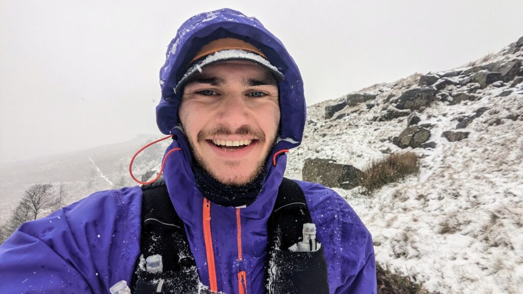
For anyone that has done the descent off Lose Hill, you will know that its steep enough in the dry. Add in the snow that had just begun to fall and my calf, and this equals a very slow and sliding trip off the hill. You could say I was more than thankful once I got a solid path beneath my feet again. Unfortunately, this relief made me forget about the climb that lay ahead up Win Hill. A steep slog away from the shelter of the tree bounded road.
A couple were walking down from the farm. Wearing a raincoat and shorts, he asked,
‘Are you alright mate?’
The way he said it. Maybe it was an actual question of concern, or my likely my slightly emotional state, either way I took it as a genuine.
I will admit I shed a tear after this. I was feeling a little bit sorry for myself. Its not the first time I’ve had a cry during an activity. I think most spectacularly was in Pembrokeshire when, tackling the roof of Soldier of Fortune E1 5b, I broke down in tears over my nan. Dangling on a rope I had no option but to get on with it. And that’s what I did here. I sat down behind a wall, put my waterproof trousers on, had a gel and more water, a couple of revels, and powered on.
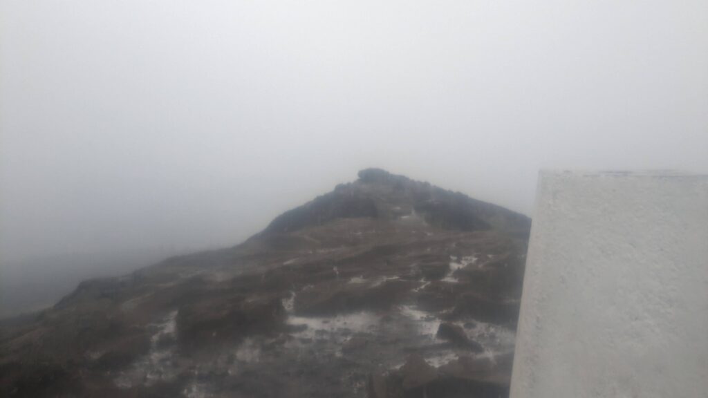
From the summit of Win Hill my view was nothing but a misty pane of grey and white. No time to enjoy this view, and I dropped down into Parkin Clough. Surprisingly, I felt stable on the first section, quickly passing numerous hikers, some responsive to my calls of afternoon, others not so much. Once into the clough I crossed paths with a rescue worker. A walker was lost on Win Hill. I told him I the route I had just taken and that I hadn’t passed anyone of the description.
Ladybower to Mortimer Road
Along Ladybower’s dam I had even less visibility, not being able to see halfway across the dam. I had overcome my earlier wobble and felt good despite my physical and mental setbacks. As I have mentioned before, whenever I am out and about, I share my location via Garmin LiveTrack with at least one other person, two if I am particularly worried about the location. I decided here to let Fiona know that despite the poor weather I was feeling good and was keen to carry on for the next section to Mortimer Road. If I felt unsafe or my physical state deteriorated, I would try hitch a ride from there back to Sheffield.
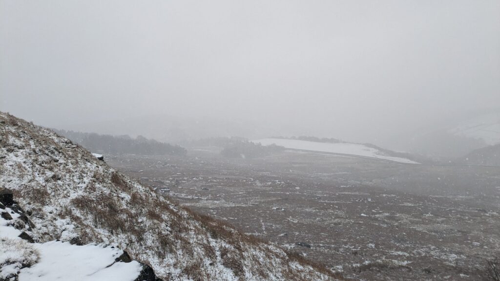
A sharp U-turn around Ladybower Inn led me to glance by Ashopton through the woodland. A crew of utilities workers sat in their vans. I will admit I ran a little bit faster when I noticed they had clocked me, tearing up the hill and out of sight before wheezing to get my breath back. The woodland provided a respite from the wind and allowed me to enjoy the rolling path and fresh snow that lay ahead, leading me up a slippery climb to Whinstone Lee Tor. At this point, my calf was giving me more grief and I was barely faster than a hiker. I was spurred on by a runner coming the opposite way, further helped by the downhill.
Mortimer Road to Nether Padley
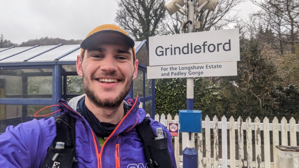
Crossing Manchester Road and over the stile I entered Hallam Moors and passed below High Neb. I found my rhythm much more consistently here, though it was occasionally broken by quick side steps by my poles breaking through the seemingly solid ground into icy puddles. I joined the Long Causeway and then dropped down through Stanage Plantation, apologising to some sheep as they cleared the path before me. I looped down past North Lees campsite and through the pleasant rolling fields to Hathersage. I thought the route took the low route to Nether Padley, so no more hills. I was wrong. Daydreaming of a chip butty from Outside given I was going to miss closing of Grindleford Station Café, I was dismayed to realise the route turns away from the centre of Hathersage and climbs through the woodland behind Hathersage Booths. One last lactic filled hill before a pleasant 3km downhill to the station, where I stopped my watch below the platform’s sign.

Stats
Elapsed time: 6:22:04
Moving time: 6:09:50
Distance: 47.34km
Elevation: 2016m
Average Pace*: 7:49/km
Average Speed*: 7.68kmph
Average HR: 139bpm
Calories: 4163
Calories Consumed: 1140
*from moving time